
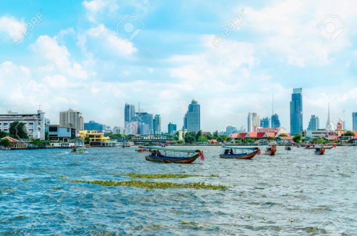
The river of Kings: The Menam Chao Phraya River
Physical Geographers have never placed the Chao Phraya River on the list of the world’s longest rivers like the Nile, or on the list of rivers with the highest volume flow like the Amazon. They have never included the Chao Phraya on the list of rivers with the most spectacular viewpoints like the Colorado River inside the Grand Canyon or idyllic, picture postcard like scenery like the Rhine in Germany.
A River of Kings
However, at the top of the list of the most commercially valuable, agriculturally abundant and culturally important rivers is the Chao Phraya or, as it is sometimes referred to, the River of Kings. Historians have surmised that the Thais have always lived in river valleys. On their emigration Southwards from China into what is now the Chao Phaya River basin several millenniums ago the Thais found a perfect place to encamp and call it home. There were other ethnic groups living in the Chao Phraya River basin when the Thais appeared, but these groups were all either displaced or forced to move to the surrounding mountains by the growing numbers of more numerous Thais who continued to flood into the whole area. These minority tribes and their descendants are the hill tribes live that in the outer areas today.
The Thais found themselves in the perfect place for growing paddy rice crops and vegetables plus tending orchards. It is also an important source of fishes and edible water plants. The grey coloured, fine silt like soil carried into the Gulf of Thailand is the world’s most ideal rice growing region, a title it has held for centuries. The Chao Phraya has made the whole country richly bountiful and prosperous.
River Origins and Geography
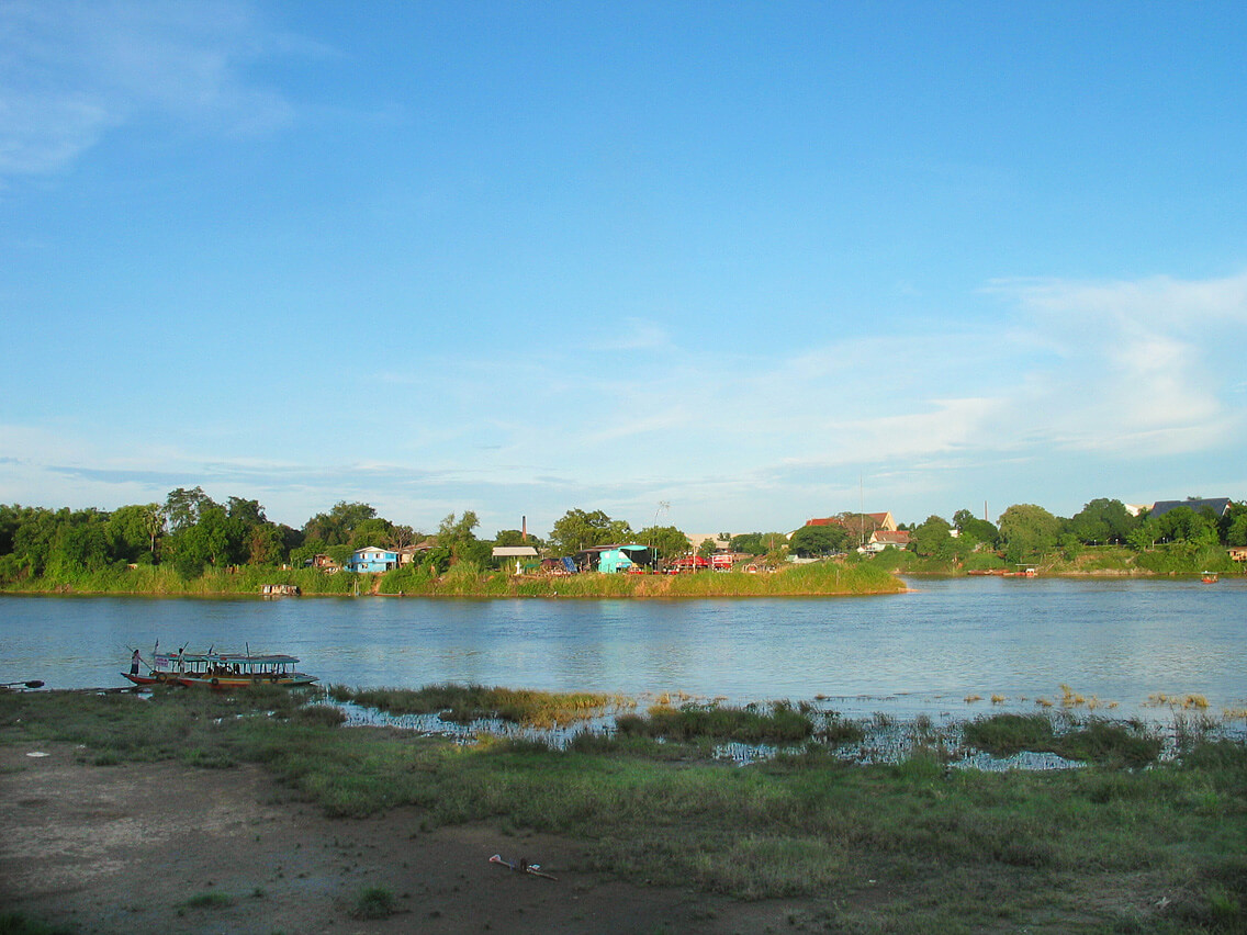
The river’s head starts at Nakhon Sawan, at the Northern edge of the Central Plains. This is where the Nan and Ping Rivers meet to form it. It slowly meanders South for 265 kilometres before ending up in the Gulf of Thailand. It is interesting to note that the Nan and Ping are actually both longer, 555 and 590 kilometres respectively. The Chao Phraya watershed is the largest watershed in Thailand. It covers approximately 35% of the nation’s land. It drains an area of 157,924 square kilometres.
Some modern geographers believe the original Chao Phraya River was much longer than it is today. Th river is believed to have actually originated in the Tibetan Himalayans and flowed into the Gulf of Thailand. But tens of thousands of years ago it was “beheaded” by the Salween River in Burma, being much younger and faster flowing. Whatever the true geological origins of the river are, there is no question that the Chao Phraya River has played a primary role in the historical development of the Thai kingdoms located in the central river valley. For centuries until now, the river has served as the primary means of transportation and communication with the outside world. It made Ayutthaya and Bangkok prosperous cities.
Where Does The Name Chao Phraya Come From?
For centuries, “farang” visitors have always wondered where the river’s original name came from, since Thais call all rivers “Menam” or “Mother of Water” that sowed a lot of confusion as in all western countries every river, stream, branch and waterway has its own name. It was King Mongkut (King Rama IV), who spoke English, offered the first credible explanation in 1850 when he was interviewed by Dr. Dan Beach Bradley for the Bangkok Courier newspaper. King Mongkut explained that Menam is a generic word like the word river is in English. The Thais attached the name of the largest town or village along it, so the name would have been “Menam Bangkok.”
Like all other rivers that flow from a low elevation headwaters with a heavy silt load, like the Mississippi, Niger and Yellow Rivers, the Chao Phraya moves slows and meanders forming sinuous loops along the way. To speed the time of transportation and shorten the distance the Thais cut canals between the loops. In 1538, a three kilometre long canal was dug at the order of King Chairachathirat called “Khlong Lat”. It shortened the route to Ayutthaya by 13-14km for ships from the Gulf of Siam. In 1542, another two kilometre canal was cut called “Khlong Lat Bangkok.” The Chao Phraya then diverted along the new canal. It’s old course became part of Khlong Bangkok Noi and Khlong Bangkok Yai. It shortened the river route by 14km.
The Chao Phraya River remains at the heart of the Thai civilisation.